
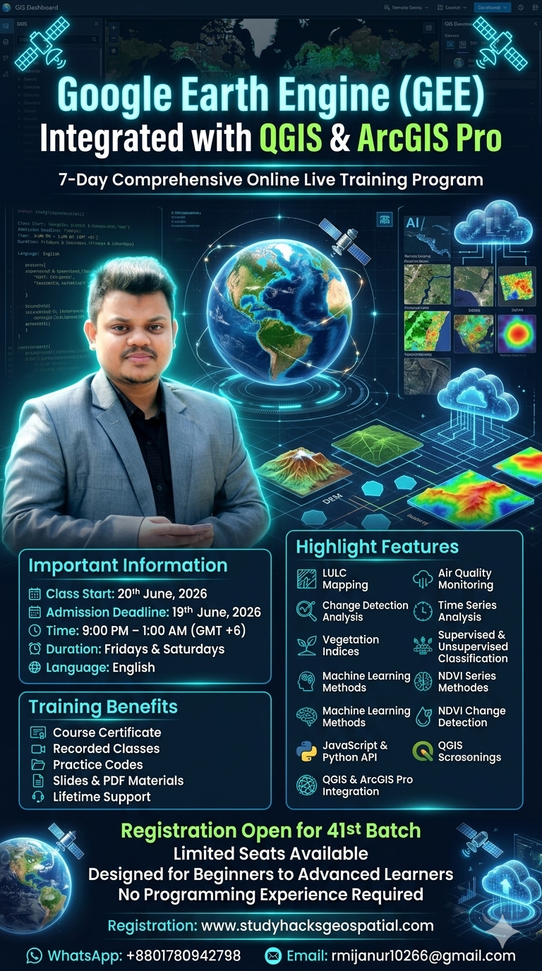
R Programming for Spatial Statistics & Modelling: Beginner to Advanced
7 Days – Hands-on training with practical exercises each day
Private training fee 1 vs 1: 800 USD
Topics Covered:
Hands-on Lab:
sf and terra for vector/raster operationsDeliverables:
Topics Covered:
tmap and ggplot2leafletHands-on Lab:
tmap and classIntleafletDeliverables:
Topics Covered:
Hands-on Lab:
spdepgstatDeliverables:
Topics Covered:
Hands-on Lab:
gstatDeliverables:
Topics Covered:
Hands-on Lab:
spatialregDeliverables:
Topics Covered:
blockCVHands-on Lab:
spatstatranger and mgcvDeliverables:
Topics Covered:
Hands-on Lab:
Capstone Project:
Deliverables:
By the end of this course, participants will be able to:
1,000.00$
WhatsApp us
Reviews
There are no reviews yet.